Reference Maps of Portland, Oregon
A set of reference maps designed to support orientation and navigation of Portland, Oregon and the Willamette Valley.
Overview
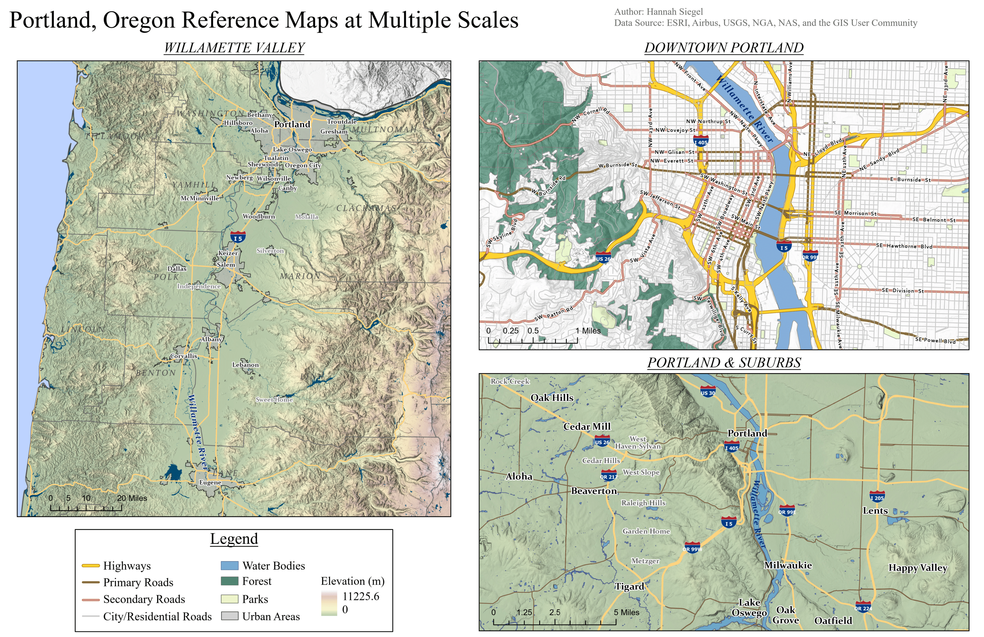
This map series presents reference maps of Portland, Oregon, emphasizing clarity, legibility, and spatial context for a general audience.
Cartographer’s Statement
Audience & Purpose
These maps are intended for users seeking a clear geographic reference for navigating Portland and the surrounding Willamette Valley.
Concepts, Narrative, & Design Choices
This series of maps is informed by principles of visual hierarchy in showing city labels and roads, balance in layout, as well as using color sparingly to show crucial variables without adding too much complexity. The most important features for navigation and spatial understanding are emphasized using bold colors and increased size. Symbolization and label density were carefully balanced as well.
Data Sources & Processing
Data for this ArcGIS Pro project were sourced from publicly available GIS datasets, including natural features like elevation and water bodies, as well as transportation and boundary layers. Features were filtered to reduce visual clutter.
Reflection
These maps are solely static reference maps and do not capture temporal change or social variables. This project reinforced the importance of restraint and omission in map design and cartographic communication.