North Atlantic Right Whales Infographic
A map infographic highlighting the dangers of expanding shipping traffic to endangered North Atlantic right whales
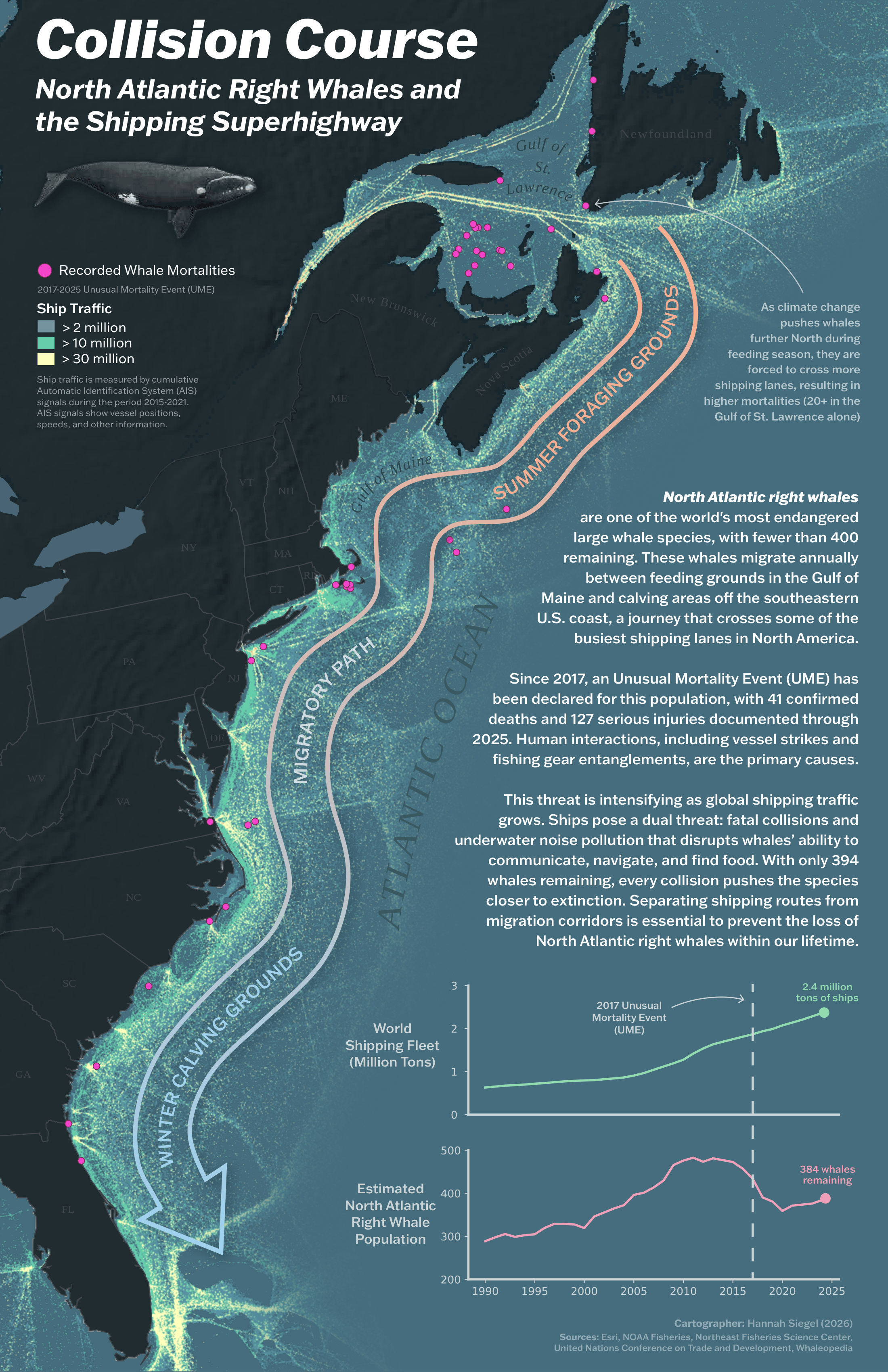
Overview
This map showcases the intersection of highly concentrated shipping lanes with the migratory path of North Atlantic right whales, highlighting the dangers that ships pose to this endangered species.
Cartographer’s Statement
My interest in this issue stems from its focus on both ocean ecology and the damage of anthropogenic impacts to the natural world. Data displayed on the map includes shipping lane traffic, whale migration patterns, and primarily human-interaction-caused whale mortalities. These data are widely available, but often visually displayed separately, in different pieces across various studies, reports, and journals. This map is an attempt to bring all of those threads together into one place, telling the whole story on a single page.
One central design decision was to make the whales’ migratory route the map’s primary focal point, with shipping traffic underneath it as a web intersecting their path. This choice reflects my goal to make the endangered whale species the center of this narrative. Additionally, displaying whale-ship collisions in striking pink points emphasizes the other crucial part of the story: the physical danger posed by such dense shipping lanes.
Reflecting on my own perspective as a cartographer and data scientist, I believe that complex ecological and climate-related problems deserve maps that don’t require a specialist to read them. A lot of important data in these fields is made inaccessible to people who might care deeply about the subject matter. In the context of right whales, my goal is to facilitate a more accessible understanding of this multifaceted ecological issue through my map.