My Data Science and GIS Projects
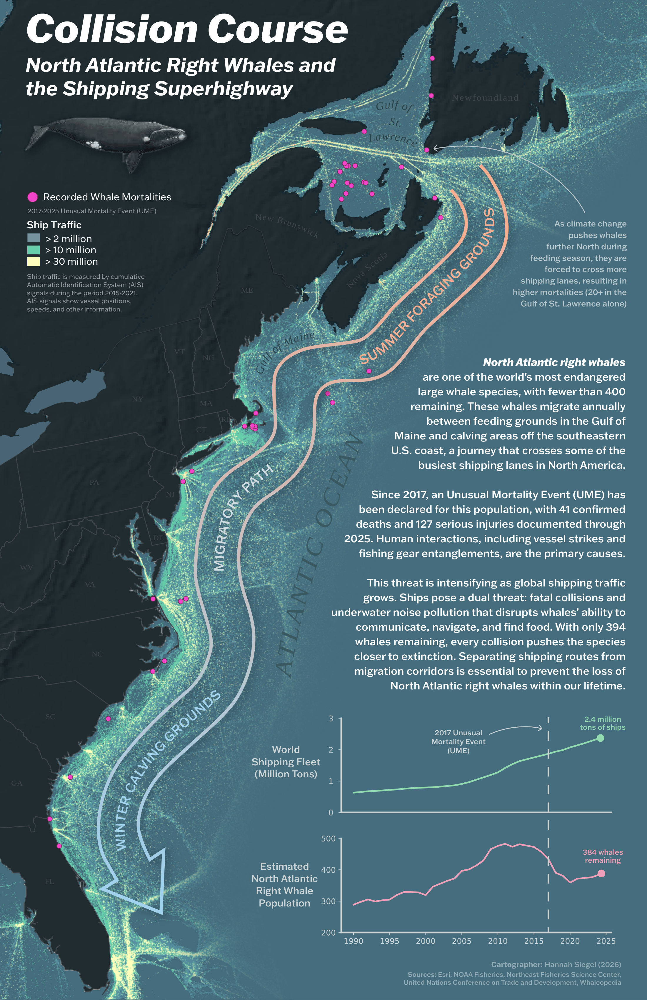
North Atlantic Right Whales Infographic
A map infographic highlighting the dangers of expanding shipping traffic to endangered North Atlantic right whales

Terrain Representations – Tahkenitch Lake
A terrain-focused map exploring elevation and landscape features around Tahkenitch Lake, Oregon.

Oregon Population Variables by County
A county-level thematic map examining population-related variables across Oregon.
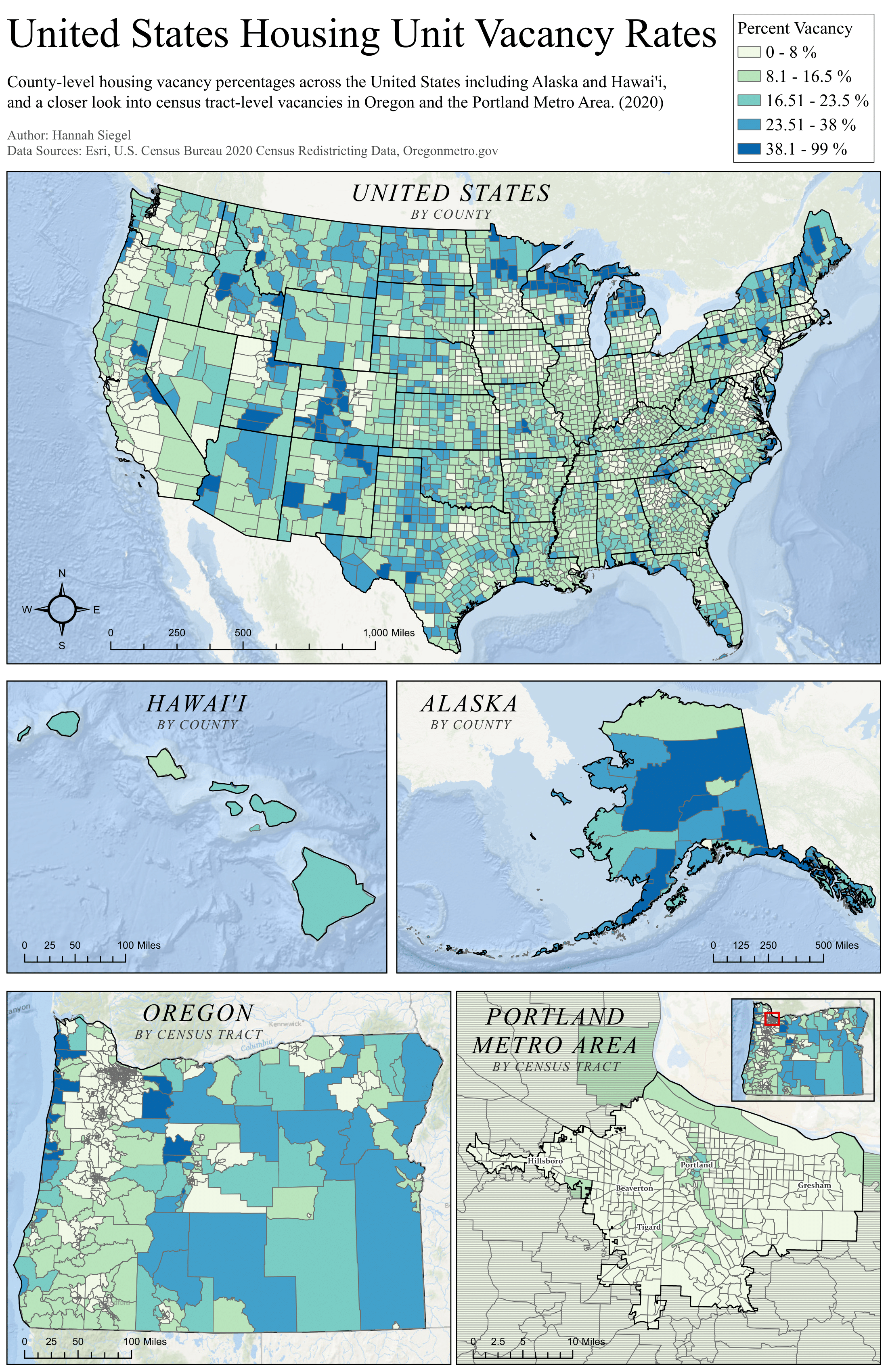
U.S. Housing Unit Vacancy Rates
Thematic maps exploring spatial patterns in housing vacancy rates across the United States.
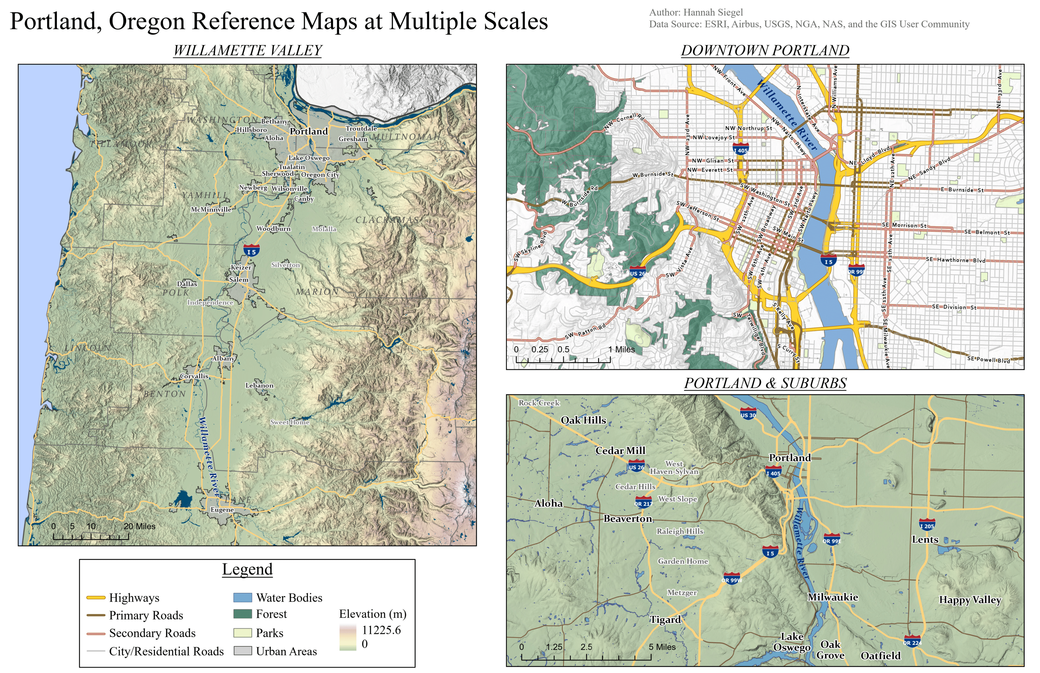
Reference Maps of Portland, Oregon
A set of reference maps designed to support orientation and navigation of Portland, Oregon and the Willamette Valley.
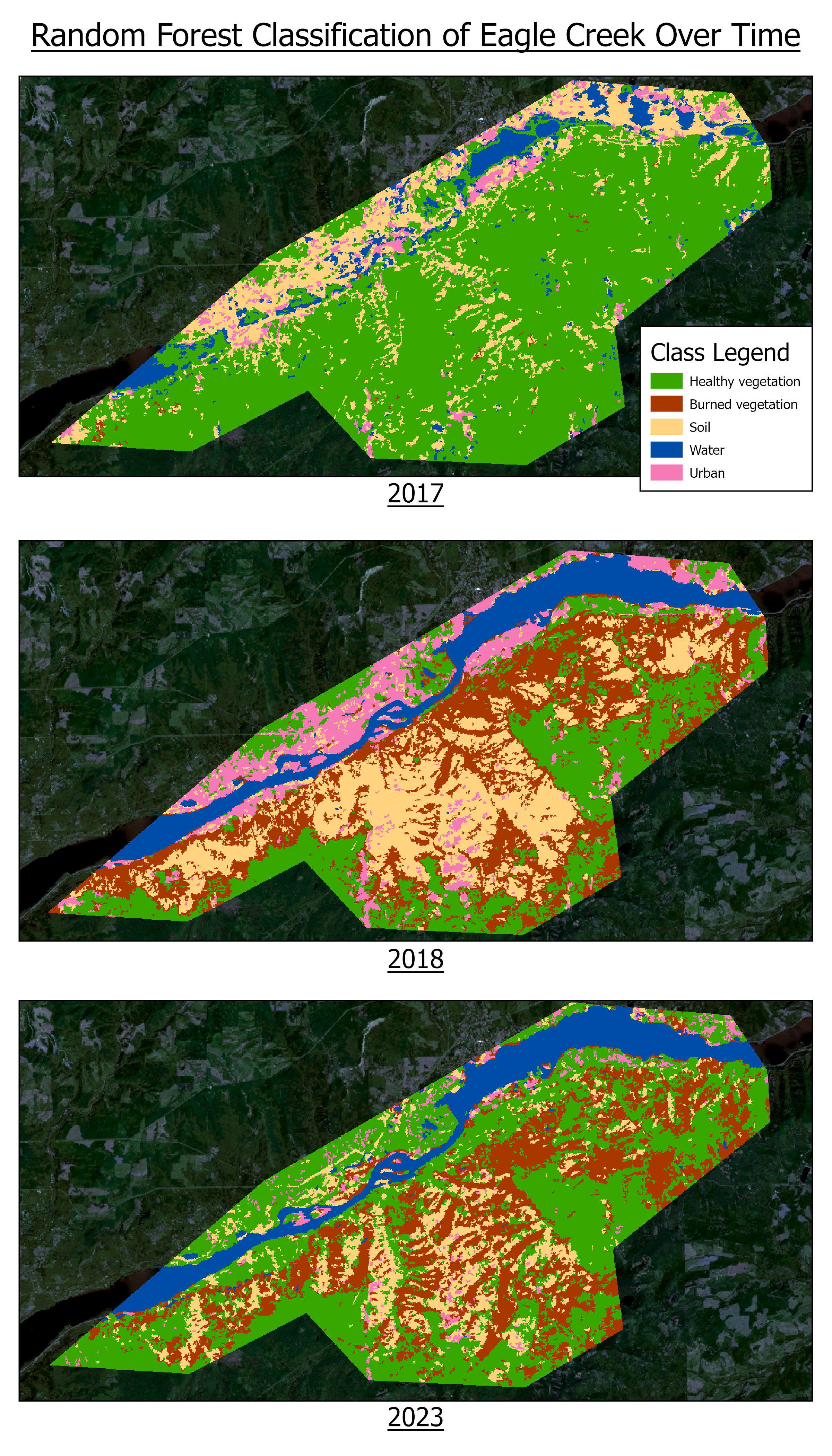
Eagle Creek Fire Remote Sensing Analysis
Analyzing vegetation damage and recovery using satellite imagery and supervised classification.
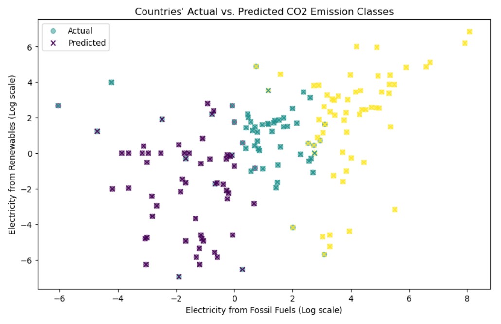
Sustainability and Energy Usage
Energy production and consumption analytics for sustainability insights.

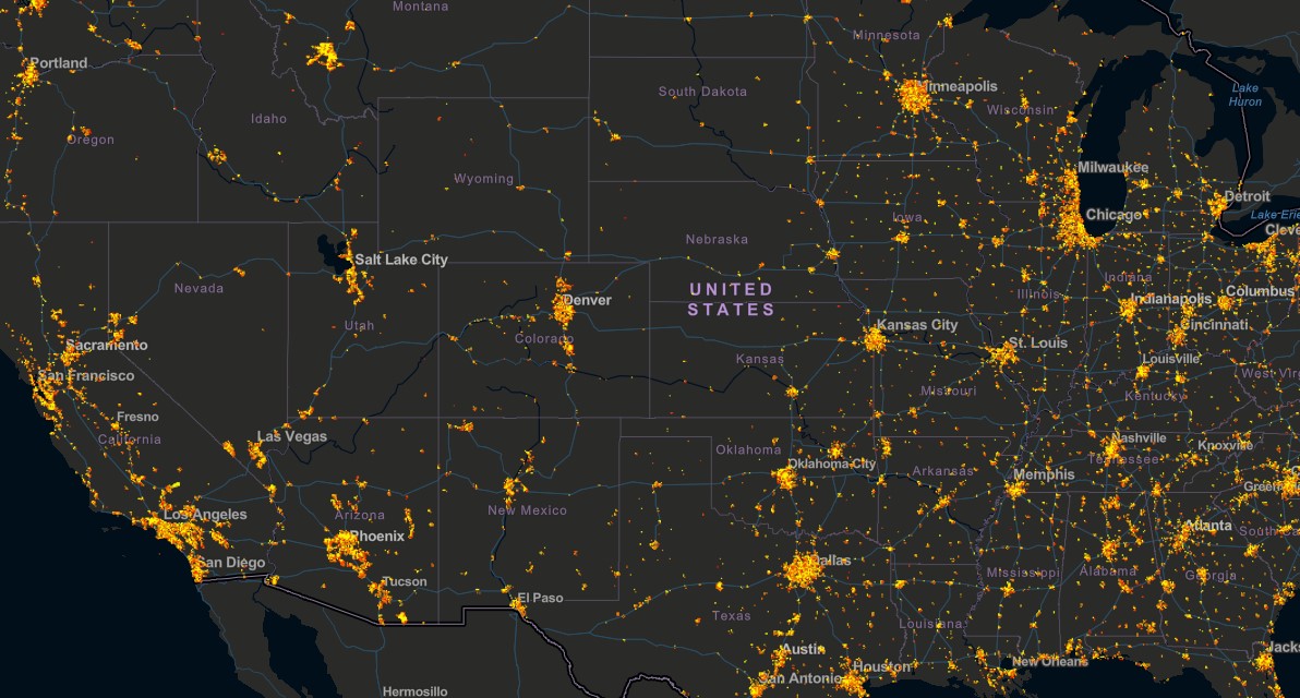
Natural Disasters Analytics Dashboard
Interactive dashboard exploring patterns and impacts of natural disasters worldwide.
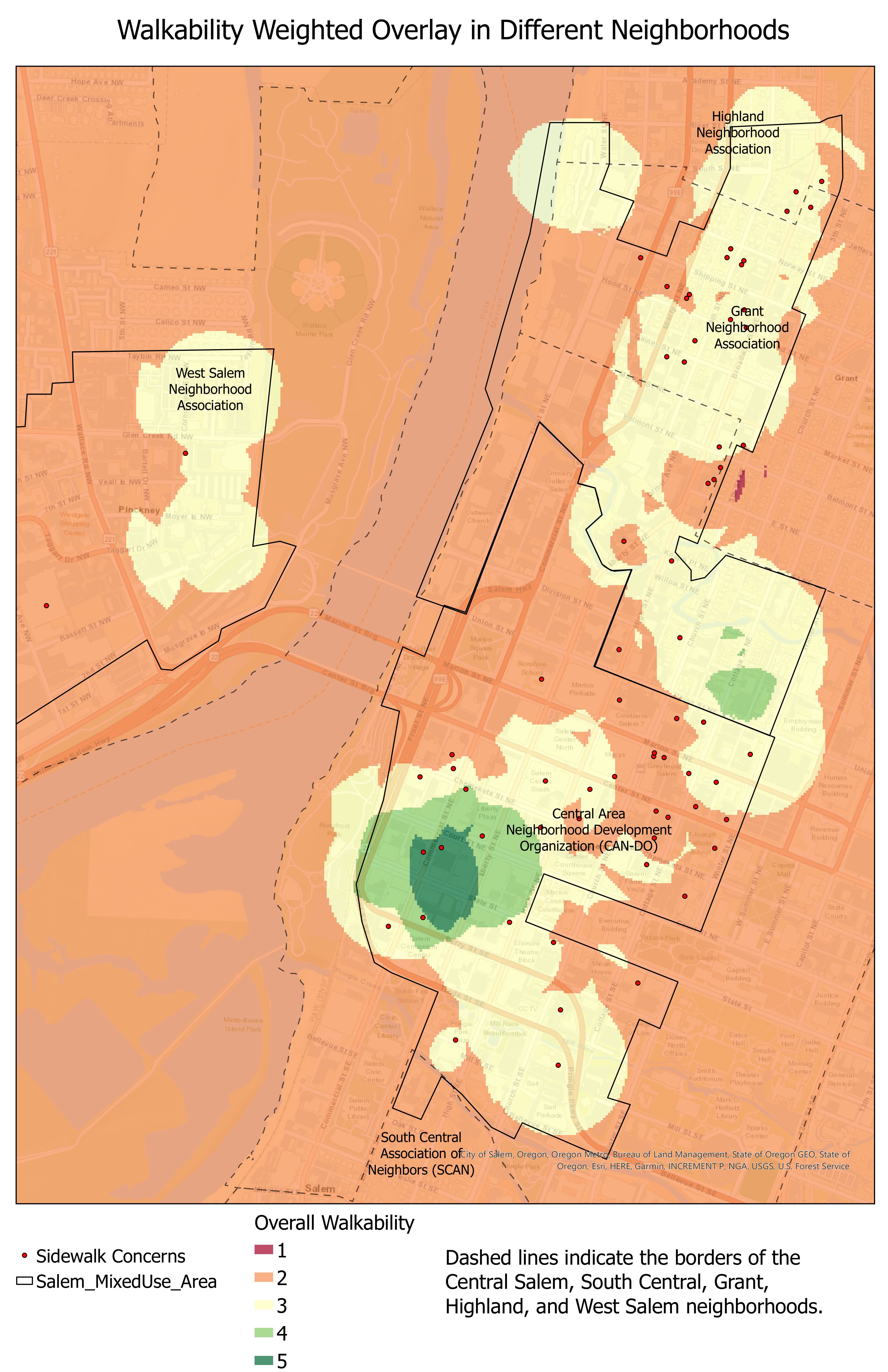
Geospatial Analysis of Walkability in Salem, Oregon
Improving pedestrian networks using spatial datasets and analysis.
Urban Heat Islands & Heat Severity StoryMap
StoryMap visualizing urban heat islands and heat severity across regions.
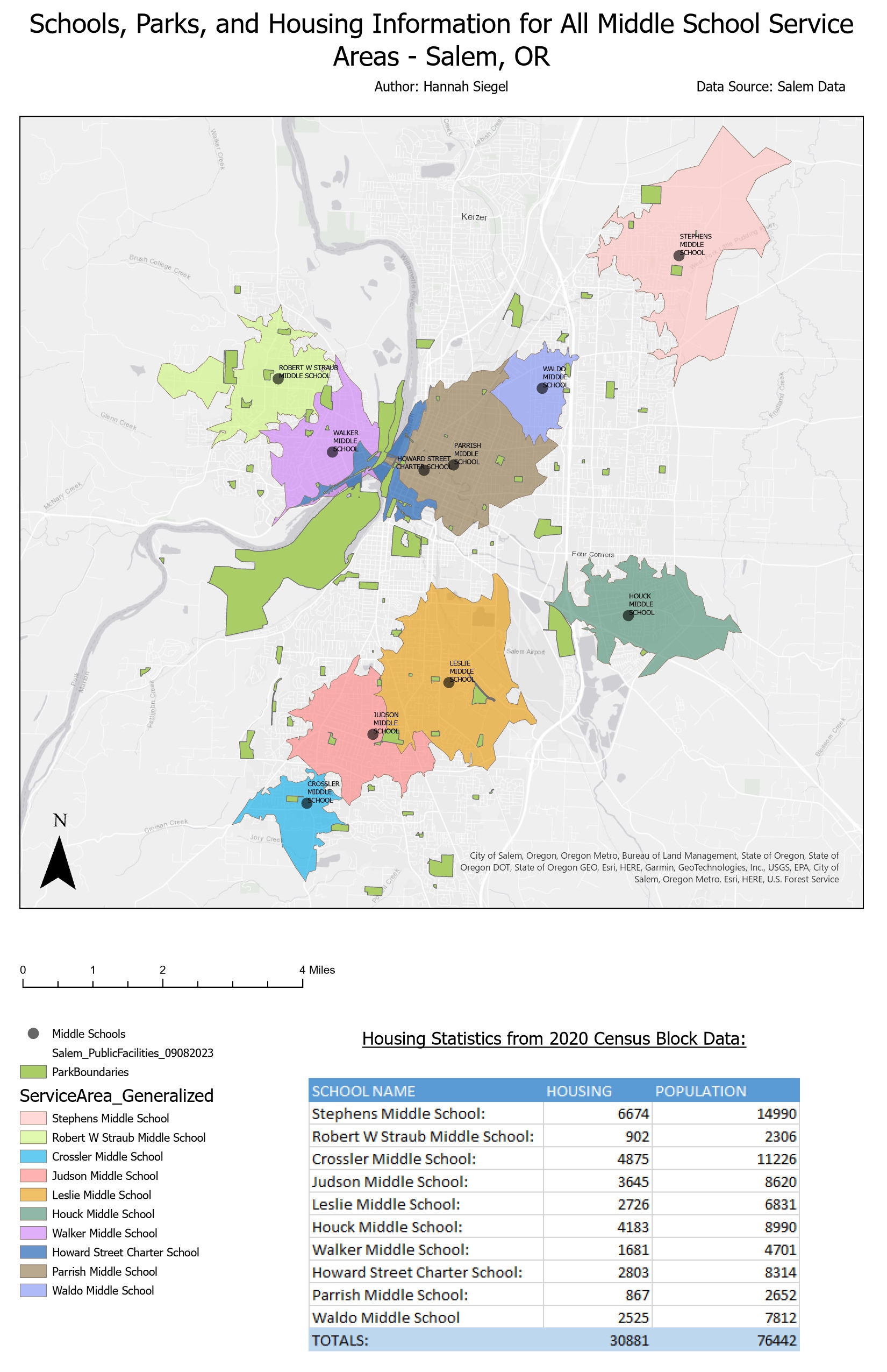
Salem, Oregon School Accessibility Maps
Maps showing school accessibility and equity in Salem, Oregon.